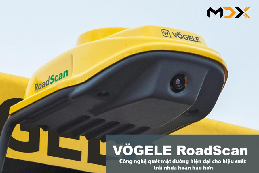
KEEPING AN EYE ON QUALITY WITH VOEGELE ROADSCAN
Making quality measurable is one of the big challenges facing contractors and clients worldwide. In road construction, it is particularly important to verify that a constant paving temperature has been maintained, as this is a key criteria for ensuring the quality and durability of roads. As a result, the significance of temperature monitoring across the entire pavement is currently on the rise in an increasing number of markets. Voegele’s RoadScan non-contacting temperature-measurement system is an innovative and economic solution for the road construction industry.
VIDEO - VOEGELE ROADSCAN
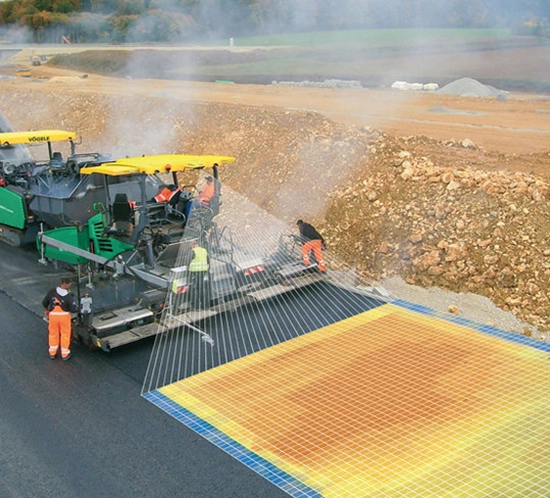
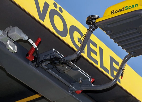
COMPREHENSIVE TEMPERATURE MEASUREMENT ACROSS FULL PAVE WIDTH
 |
|
| GPS-referenced base temperatures recorded in front of the undercarriage. GPS-referenced paving temperatures recorded behind the screed. Weather data recorded by the optional weather station. RoadScan is available for all “Dash 3” machines of the Universal and Highway classes. See more the Univeral class and Highway Class of Vogele at: HERE | |
 |
 |
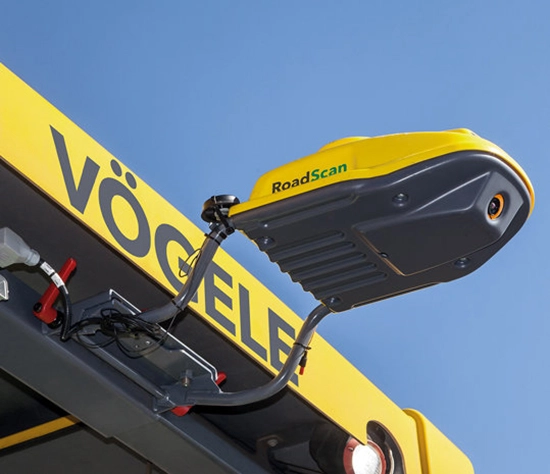
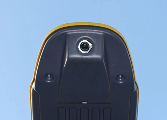
| GPS-referenced paving temperatures recorded behind the screed: An infrared camera installed on the roof of the paver scans the asphalt pavement behind the screed. A GPS receiver in the housing notes position, ensuring exact recording of temperature data. | GPS-referenced base temperatures recorded in front of the undercarriage: A pyrometer installed in front of the undercarriage measures the base temperature ahead of paving and records it on a GPS-referenced basis. |
 |
|
|
Weather data recorded by the optional weather station: Wind strength, Wind direction, Ambient temperature, Air pressure, Humidity. Measurement by infrared camera: - Scan grid tile: 25 x 25cm - Image resolution: 16 individual readings - Measuring range: 0 to 250°C - Margin for error: max. ± 2% 16 individual measurements are performed in each tile of the scan grid. For a 10m pave width, this is 40 tiles, or 640 individual measurements. |
|
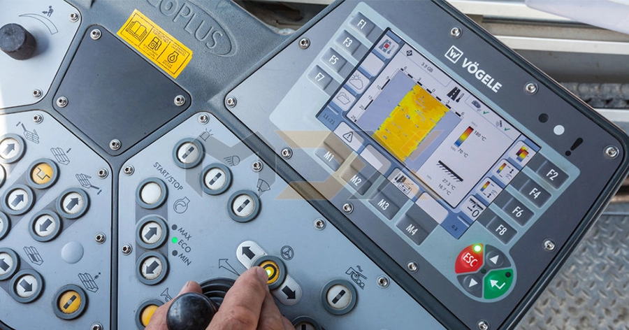
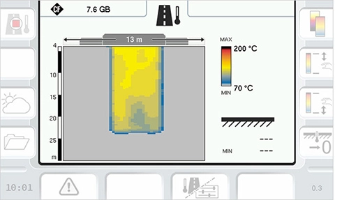
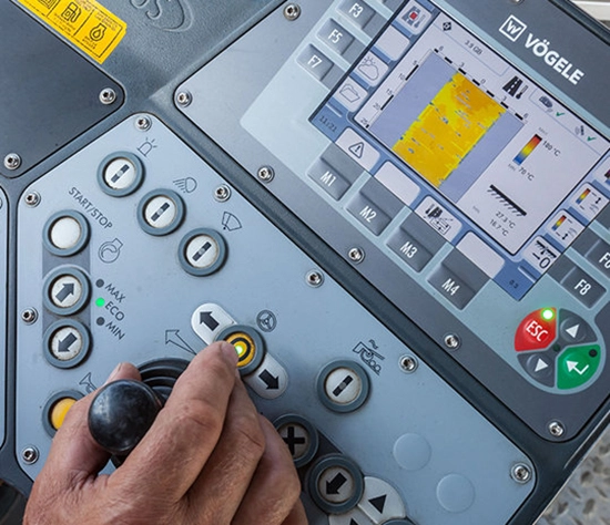
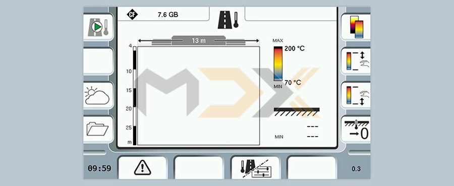
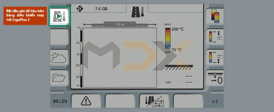
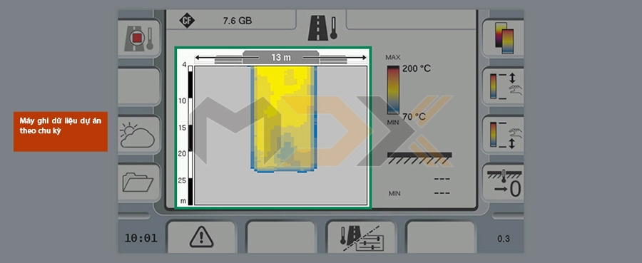
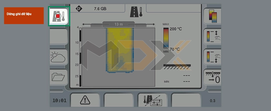
REAL-TIME DISPLAY ON THE PAVER OPERATOR’S ERGOPLUS 3 CONSOLE
 |
|
|
Integration in ErgoPlus 3 for straightforward operation The measuring system is installed on the roof before use. It is ready for use as soon as it has been connected and requires no further adjustment. The system is activated from the paver operator's ErgoPlus 3 console. The operator can read the temperatures currently being recorded off the display in real time. These temperatures are visualized in thermal images. As a result, any deviation from required paving temperature is detected immediately. |
|
 |
|
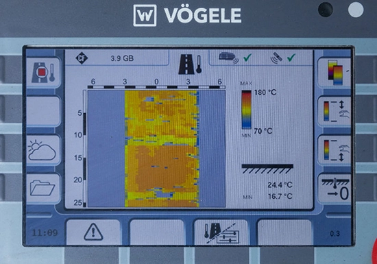
| The following data are displayed: Thermography data, Weather data | |
|
|
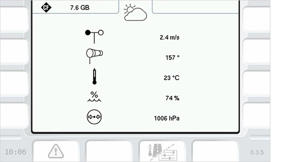 |
| Thermography data (temperature of the asphalt in the measuring range) | Weather data (wind strength, wind direction, ambient temperature, air pressure, humidity) |
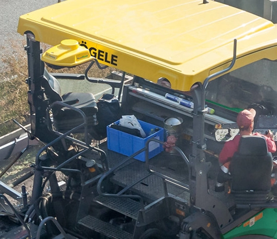
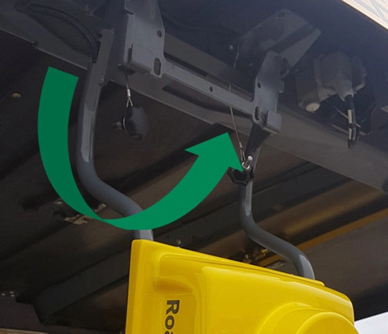
MEASURING SYSTEM EASY TO INSTALL
|
The measuring system is simple to install on the roof: - Defined position on the paver - Quick-fit bracket - Plug&play: no system setup required after installation - Can be installed safely from the operator platform - Connections and components are protected - Simple to handle on several machines: The measuring system can be switched from one VÖGELE paver to another without any calibration or adjustment - simply plug&play. |
|
 |
 |
| Quick-fit bracket | Defined position on the paver |
 |
 |
| Can be installed safely from the operator platform | Plug&play: no system setup required after installation |
| Connections and components are protected | 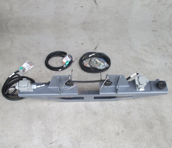 |
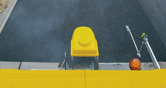
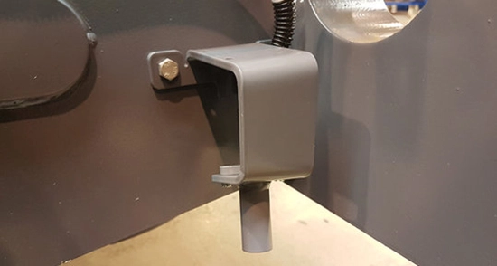
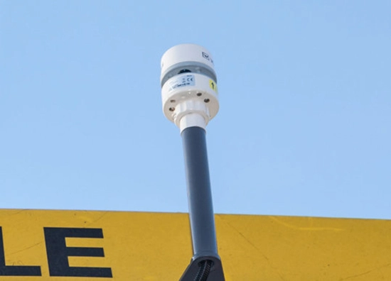
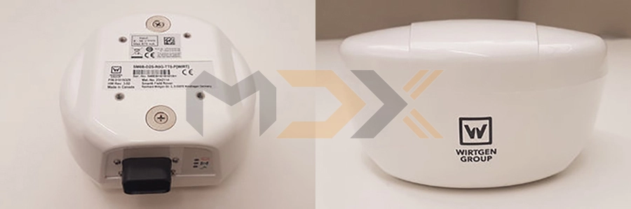
ROBUST DESIGN KEEPS TECHNOLOGY RELIABLE
 |
 |
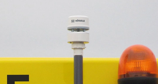
| Weather station | Thermoscanner with GPS receiver in a robust housing with no moving parts |
 |
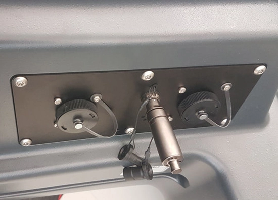 |
| Bracket and cabling | USB port with special USB stick |
| Sensor for measuring base temperature in front of the paver | 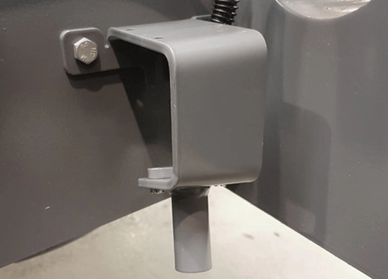 |
HIGH-PRECISION GPS RECEIVER PERMANENTLY INTEGRATED IN ROADSCAN
 |
|
 |
|
|
The GPS receiver is fully fitted in the RoadScan housing. This records the exact position data for the temperatures. - Dual-frequency 20Hz GPS antenna - Precision: 0.18 to 1.5m |
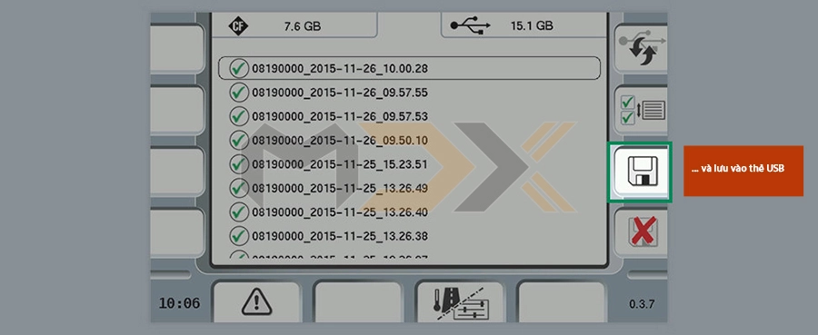
KEY PARAMETERS RECORDED FOR ANALYSIS
 |
|
 |
|
 |
|
 |
|
 |
|
 |
|
 |
A BRIEF ASIDE... VOEGELE ROADSCAN AND WITOS PAVING
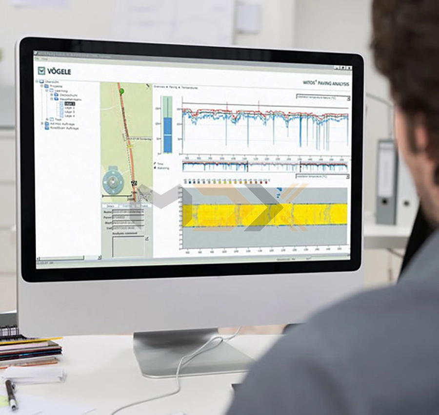
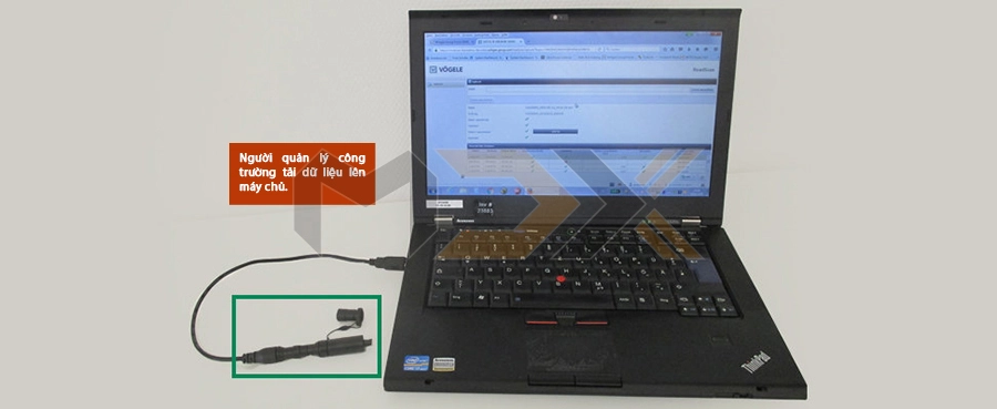
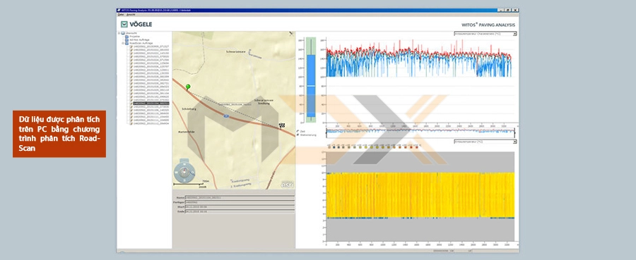
If Voegele RoadScan is used in combination with the WITOS Paving process management solution, other data can also be evaluated:
- Where did which lorry unload material?
- What was pave speed?
- Where did the paver wait?
- How many mix lorries were on the job site?
- How long were waiting times and can the number of mix lorries be reduced?
- What costs were caused by waiting times?
Voegele RoadScan in the field
Cutting-edge Voegele Technology in Major Project
WHAT IS ROADSCAN AND WHAT CAN IT DO?
- System for comprehensive temperature measurement up to a pave width of 10m
- Base temperatures in front of the paver and paving temperatures behind the screed are recorded
- Weather data can be recorded using the optional weather station
- Detected parameters are recorded for subsequent analysis
- Robust system is simple to install with a quick-fit bracket on the roof of the paver
- GPS receiver permanently installed in the RoadScan housing
News Related
Tags: roadscan, vogele paver